Tropical Storm Francine likely to become hurricane before Louisiana landfall, forecasters say
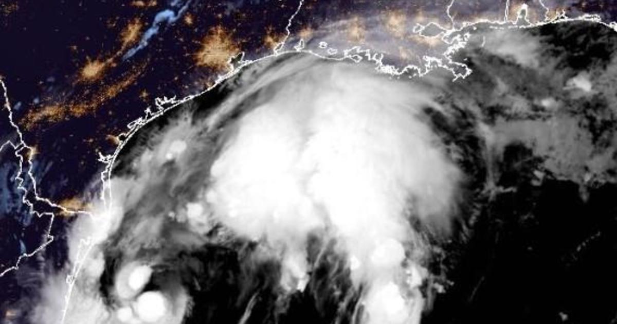
Tropical Storm Francine, which developed in the Gulf of Mexico Monday, is expected to strengthen into a hurricane Tuesday and make landfall Wednesday over Louisiana, the National Hurricane Center says.
“Francine is anticipated to be just offshore of the coasts of northeastern Mexico and southern Texas through today,” the center said early Tuesday, “and make landfall in Louisiana on Wednesday. Francine will likely become a hurricane today, with significant strengthening expected before it reaches the coast.”
The storm “is expected to bring storm total rainfall of 4 to 8 inches, with local amounts to 12 inches across much of Louisiana and Mississippi through Friday morning,” the center added. There is potential for “considerable” flash and urban flooding.
As of 8 a.m. EDT Tuesday, Francine’s center was about 125 miles southeast of the mouth of the Rio Grande and approximately 395 miles south-southwest of Cameron, Louisiana. It was moving north-northwest at 5 mph with maximum sustained winds of 65 mph. Once winds hit 74 mph, Francine will obtain hurricane status.
NOAA/National Hurricane Center
Louisiana Gov. Jeff Landry declared a state of emergency on Monday evening ahead of Francine’s arrival.
“This State of Emergency will allow parishes statewide to have the resources to help protect the life, safety, and welfare of the citizens of Louisiana,” Landry said on social media. “Throughout this process, we will remain in constant contact with local officals and first responders and will assist them in every step of the way.”
A hurricane warning was expanded Tuesday morning for the Louisiana coast from Sabine Pass to Grand Isle, with a tropical storm warning in place from there eastward to the mouth of the Pearl River, including metropolitan New Orleans, Lake Pontchartrain and Lake Maurepas. Storm surge warnings were in effect for areas from High Island, Texas, to the mouth of the Mississippi River and Vermilion Bay. A storm surge watch extended to the Mississippi-Alabama border.
The Miami-based hurricane center explains that a hurricane warning means hurricane conditions are expected somewhere within the warning area, and it’s typically issued hours before the earliest arrival of tropical-storm-force winds that would hinder weather preparations. A hurricane watch means hurricane conditions are possible within the watch area, and a storm surge warning means there’s a danger of life-threatening inundation, from rising water moving inland from the coastline, during the next 36 hours in the indicated locations.
Francine’s development followed an unusually calm August and early September in the Atlantic hurricane season. Francine is the Atlantic season’s sixth named storm.
Experts had predicted one of the busiest Atlantic seasons ever and, The Associated Press notes, Colorado State University researchers said last week they still expect an above-normal season overall.


